Canada sits at the northern terminus of four recognized flyways — the Atlantic, Mississippi, Central, and Pacific — and serves as either a breeding ground or a staging corridor for an estimated 450 species each year. Understanding how these routes overlap, where they narrow into bottlenecks, and when traffic peaks gives field observers a practical framework for planning trips and interpreting what they see.
The Atlantic Flyway
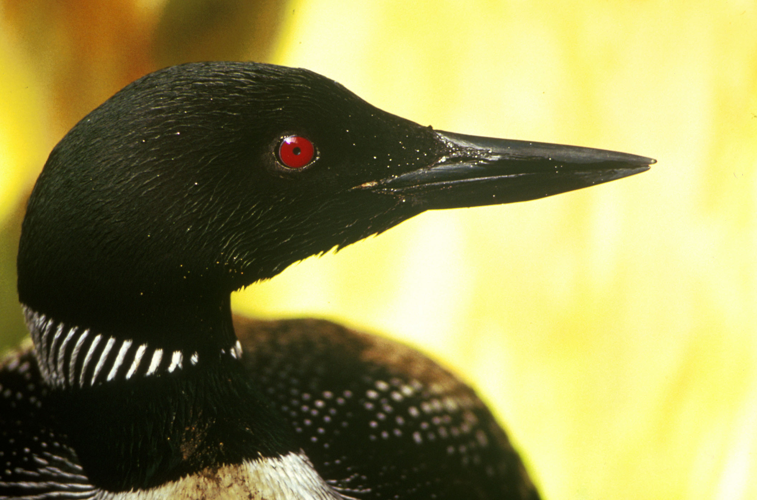
Running along the eastern seaboard from the Maritimes to the Caribbean, the Atlantic Flyway funnels shorebirds, waterfowl, and passerines through Nova Scotia, New Brunswick, and the Gulf of St. Lawrence every August and September. The Bay of Fundy is the single most significant bottleneck on this route: at peak tides, exposed mudflats in Minas Basin hold concentrations of Semipalmated Sandpipers that reach into the hundreds of thousands. These birds are almost exclusively staging for a transoceanic crossing to South America, fuelling on amphipods and biofilm over a period of roughly two weeks before departing in coordinated nighttime flights.
Later in the season — October through early November — the same corridor carries sharp-shinned hawks, Merlins, and American Kestrels southwest through Cape Breton and down the Fundy coast. Hawk-watching points at Brier Island, Nova Scotia, regularly record combined daily raptor counts exceeding 3,000 birds during northwest-wind events following cold fronts.
The Mississippi Flyway
Inland from the Atlantic corridor, the Mississippi Flyway draws birds out of the James Bay lowlands and the clay belt forests of northern Ontario. The flyway is at its most concentrated in the marshes of Lake Erie's north shore, where Ontario's Long Point acts as a geographic funnel. Species diversity at Long Point in May rivals anything in eastern North America: warblers, vireos, flycatchers, and thrushes that have crossed the lake overnight drop in exhausted numbers into the woodlots and dune scrub.
For waterfowl, the flyway's importance shifts to autumn. Tundra-breeding geese — including Greater White-fronted and Canada Geese — stage on the agricultural fields of southwestern Ontario and Quebec through October, moving south in response to freeze-up rather than on a fixed calendar.
The Central Flyway
The prairies define the Central Flyway in Canada. Breeding populations of Franklin's Gulls, Marbled Godwits, and Wilson's Phalaropes concentrate in the pothole lakes of Saskatchewan and Manitoba before moving southwest across the Great Plains. For observers, the window from mid-July to late August represents the most productive period: juvenile shorebirds that hatched in June appear in large numbers at shallow prairie lakes, often alongside adults that have already begun the return journey south.
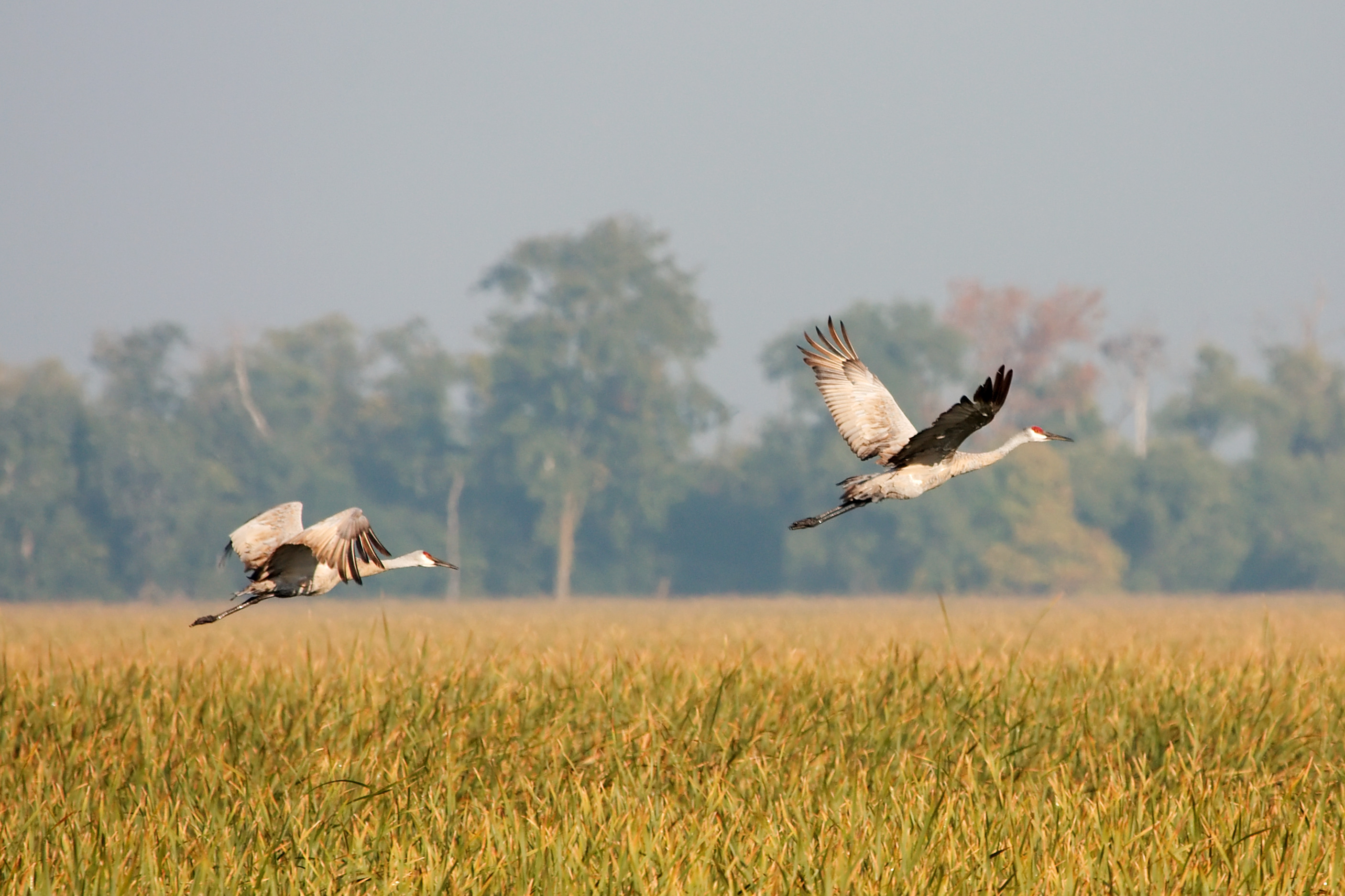
Whooping Cranes follow this corridor on their annual migration between Wood Buffalo National Park in the Northwest Territories and Aransas National Wildlife Refuge in Texas. The population remains small — under 600 wild birds as of 2025 — and each individual's route through Saskatchewan is documented annually by the International Whooping Crane Recovery Team. Staging birds stop most reliably at Quill Lakes, where they forage in harvested grain fields.

The Pacific Flyway
British Columbia's coast is one of the most productive sections of the Pacific Flyway, a route that runs from Alaska and the Yukon to Baja California and beyond. The estuary at the mouth of the Fraser River in the Lower Mainland — particularly the mudflats at Boundary Bay and Roberts Bank — hosts shorebirds numbers in spring and fall that rival the Bay of Fundy on a per-area basis. Western Sandpipers staging here in late April and early May can number over 1.5 million birds in a single season.
Inland, the Okanagan Valley channels raptors along the ridge system: Swainson's Hawks, Ferruginous Hawks, and Golden Eagles move south through the valley in September and early October, concentrated by the terrain into corridors where counts from fixed watch-points accumulate rapidly on good flight days.
Timing Across Flyways
Migration is not uniform across seasons. Spring movement tends to be faster and more compressed than autumn — birds moving north are under hormonal pressure to reach breeding grounds, and they fly longer legs with fewer stops. Autumn migration is diffuse, extended over weeks, and involves larger numbers because newly fledged young are traveling alongside adults.
In practical terms, the most productive observation windows by flyway are:
- Atlantic: May 10–25 for passerines; August 15 – September 10 for shorebirds; late October for raptors.
- Mississippi: May 5–20 at Long Point; September 15 – October 20 for waterfowl staging.
- Central: July 20 – August 30 for shorebirds at prairie lakes; late September for Whooping Crane passage.
- Pacific: April 25 – May 10 for shorebird peaks at Fraser Delta; September 1–30 for raptors in the Okanagan.
Stopover Habitat and Its Decline
The value of a migration corridor depends entirely on the quality of stopover habitat along it. Shorebirds need shallow-water mudflats with accessible invertebrate prey; passerines need woodlots or shrubby cover with sufficient insect abundance to fuel rapid fat deposition. Both types of habitat have declined in Canada over the past 40 years — coastal wetland loss in the Maritimes, drainage of prairie potholes, and the conversion of natural river edges to agricultural bufferless fields have all reduced carrying capacity at critical staging areas.
For observers interested in supporting migration ecology, the most direct contribution is reporting sightings to national databases. eBird Canada aggregates records that feed into the range maps and population trend analyses used by agencies including Birds Canada and the Canadian Wildlife Service.